
Devlog #1: Capturing the Real World - Photogrammetry in Ultimate Farmer
Environmental development for Ultimate Farmer is increasingly moving beyond the screen and into real agricultural environments. As part of our work on terrain and surface materials, we have started collecting real-world data from fields using photogrammetry.
Our first captures focus on cultivated soil and crop residue left across the surface following agricultural work. These scans are being used to build a growing reference library of agricultural surfaces, giving our environment team detailed information about their shape, scale, colour and natural variation.
The process supports our wider objective of creating agricultural environments grounded in the characteristics of real fields.
Taking Development into the Field
Photogrammetry uses a series of overlapping photographs to reconstruct a physical surface digitally. Each area is photographed systematically from multiple positions and angles, giving the processing software enough information to identify common points between individual images and calculate their position in three-dimensional space.
During our field sessions, we photograph selected areas at close range and record physical measurements that provide an accurate scale reference during reconstruction. The resulting dataset captures both colour information and the three-dimensional structure of the ground.
This level of detail allows us to study individual clods of soil, changes in surface height, depressions, stones, roots and fragments of organic material. For harvested surfaces, the same process records the distribution, direction and density of crop residue across the ground.
Reconstructing Agricultural Surfaces
Once the photography has been completed, the images are processed to calculate the position of each camera and reconstruct the captured area.
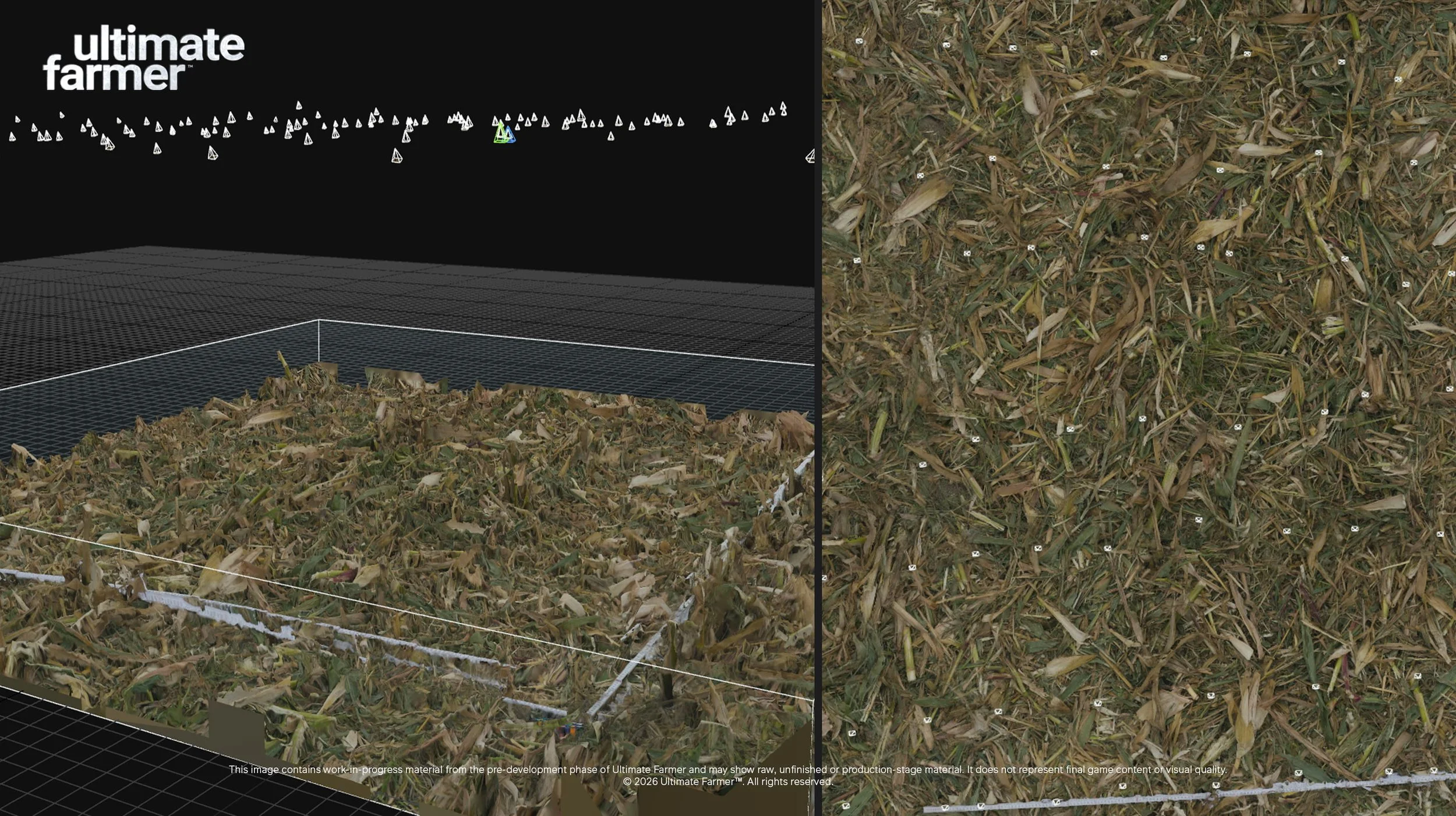
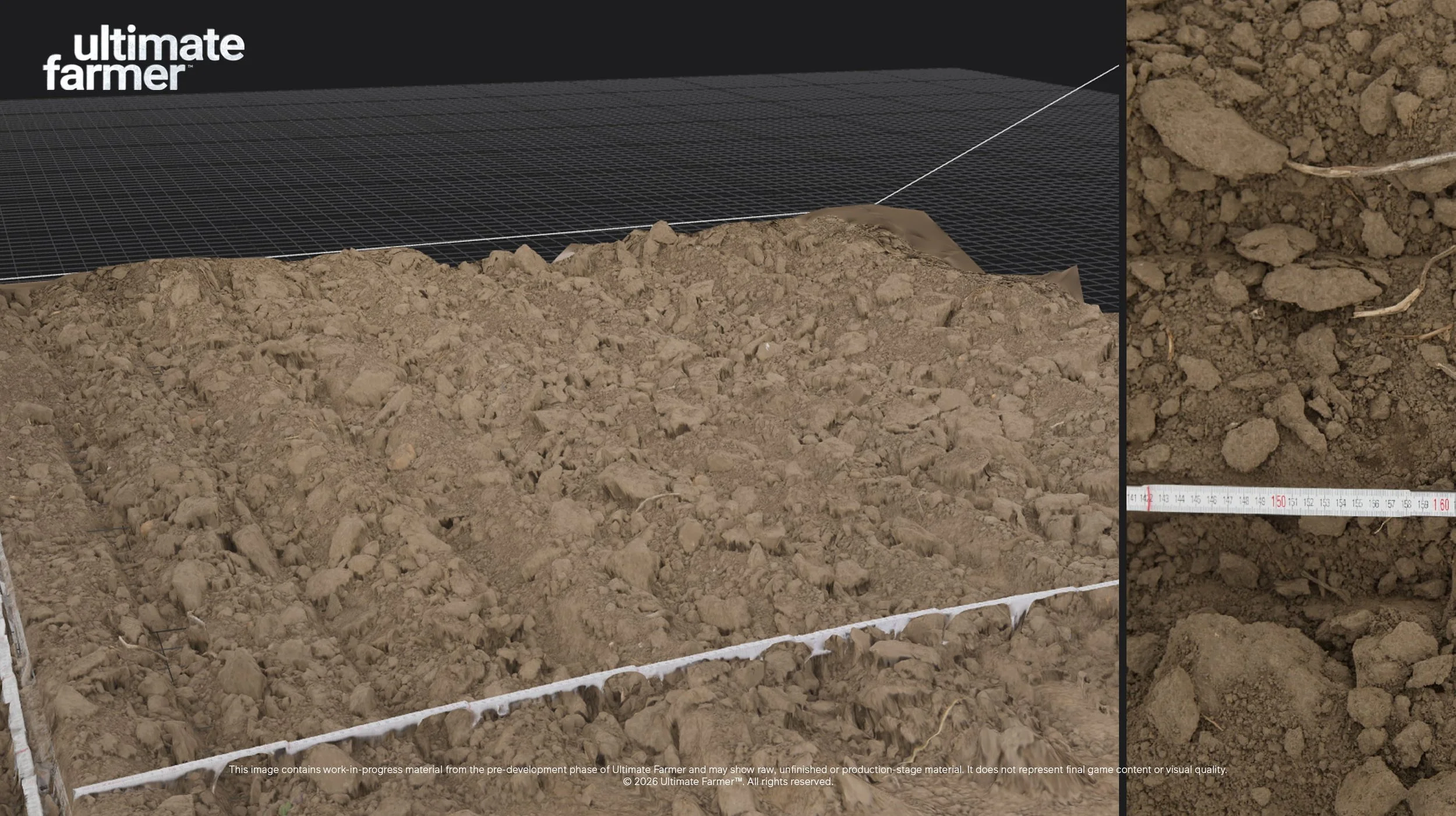
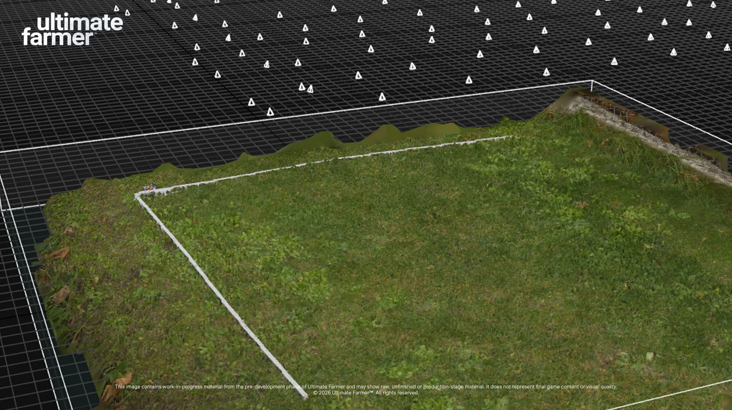
The examples shown here demonstrate some of our first reconstructed surfaces. Dozens of individual camera positions can be seen surrounding the scanned area, each contributing information to the final result. Reference measurements captured on location remain visible within the reconstruction and help us verify the dimensions of the surface.
The cultivated soil scan shows the amount of physical variation present within a relatively small section of a field. Individual clods vary considerably in size, shape and orientation, with smaller material filling the spaces between them. Changes in height occur continuously across the surface and create the irregular profile associated with recently worked ground.
Our crop-residue capture contains a different type of information. Leaves, stalks and fragmented plant material overlap across the surface at different angles and densities. Photogrammetry records this natural distribution in considerable detail and provides a useful reference for developing harvested field surfaces.
From Scan to Game Asset
The initial reconstruction contains a very large amount of geometry and texture information. This raw data provides the starting point for the next stage of production, where the scan is cleaned, processed and prepared for use within our environmental pipeline.
Geometry can be optimised while surface information is extracted into textures and material data suitable for real-time rendering. The process allows important details from the original capture to remain visible while keeping the resulting assets appropriate for the scale and performance requirements of Ultimate Farmer.
These captures can then contribute to materials used across larger areas of terrain. Surface colour, height variation, fine detail and other characteristics can be processed separately and incorporated into the systems responsible for rendering fields and agricultural ground.
The same source data also provides our environment team with an accurate visual reference throughout production. Real dimensions, surface density and the scale of individual details can be studied directly from the reconstruction when developing related assets and materials.
Supporting the Ultimate Farmer Terrain System
Photogrammetry forms part of the wider terrain and ground development currently underway in Ultimate Farmer.
Our terrain system is being developed to connect soil conditions, vegetation, crops and machinery interaction. Different areas of ground will store data including moisture, with fertilisation, diseases and pests planned as additional parameters as development progresses. These conditions will influence the state and development of vegetation and crops within individual areas.
Surface materials need to visually support those changing conditions. Cultivated ground, dry soil, wetter areas, crop residue and other field states each have their own characteristics, and collecting real-world references gives us detailed source material for their development.
Machinery interaction adds another layer to this system. Agricultural operations change the appearance and condition of a field, so the environmental pipeline needs enough surface variation to represent different stages of fieldwork convincingly. The photogrammetry library will provide additional material for developing those visual states as the terrain system continues to expand.
Balancing Detail and Performance
Agricultural environments cover large areas, and a farming simulation can place significant demands on rendering and simulation at the same time. Vehicles, crops, vegetation, terrain, weather and environmental systems may all be active while the player looks across several fields.
Raw photogrammetry captures can contain extremely dense geometry and high-resolution texture information. Processing and optimisation are therefore an important part of bringing these captures into a real-time environment. Surface information can be converted into efficient materials and assets while preserving the visual characteristics that made the original scan useful.
This forms part of our broader approach to environmental development in Ultimate Farmer. High-quality source data gives us a strong starting point, while the final implementation is developed around the requirements of a large-scale farming simulation.
Building an Agricultural Surface Library
Our first field sessions have given us detailed captures of cultivated soil and harvested crop residue, and this library will continue to grow during development.
Future scanning sessions can document additional soil conditions, field states and environmental details. Capturing these surfaces ourselves also allows us to record measurements and supporting reference photography alongside the photogrammetry data, creating a more complete reference for the environment team.
Each scan contributes another piece of real agricultural information to the project. As the library expands, these datasets will support the development of terrain materials, field surfaces and the wider environments being created for Ultimate Farmer.
From the Field to Ultimate Farmer
The environments in Ultimate Farmer are being developed through a combination of terrain technology, vegetation, materials, lighting, weather, procedural systems and real-world reference data. Photogrammetry adds another part to that production pipeline by giving us highly detailed digital records of the agricultural surfaces we are working to recreate.
Our recent field sessions mark the beginning of this work. The soil beneath a tractor, the residue left across a harvested field and the irregular structure of worked ground are small details within a much larger simulation, but together they contribute to how believable that world feels.
As development continues, we’ll be spending more time in real agricultural environments collecting the references and data that will help shape the digital ones inside Ultimate Farmer.
